UKHab & BNG
UKHab Mapping for BNG
UKHab is the current UK standard for habitat mapping and condition. It replaced Phase 1 and feeds PEAs, EcIAs and mandatory biodiversity net gain calculations.
Overview
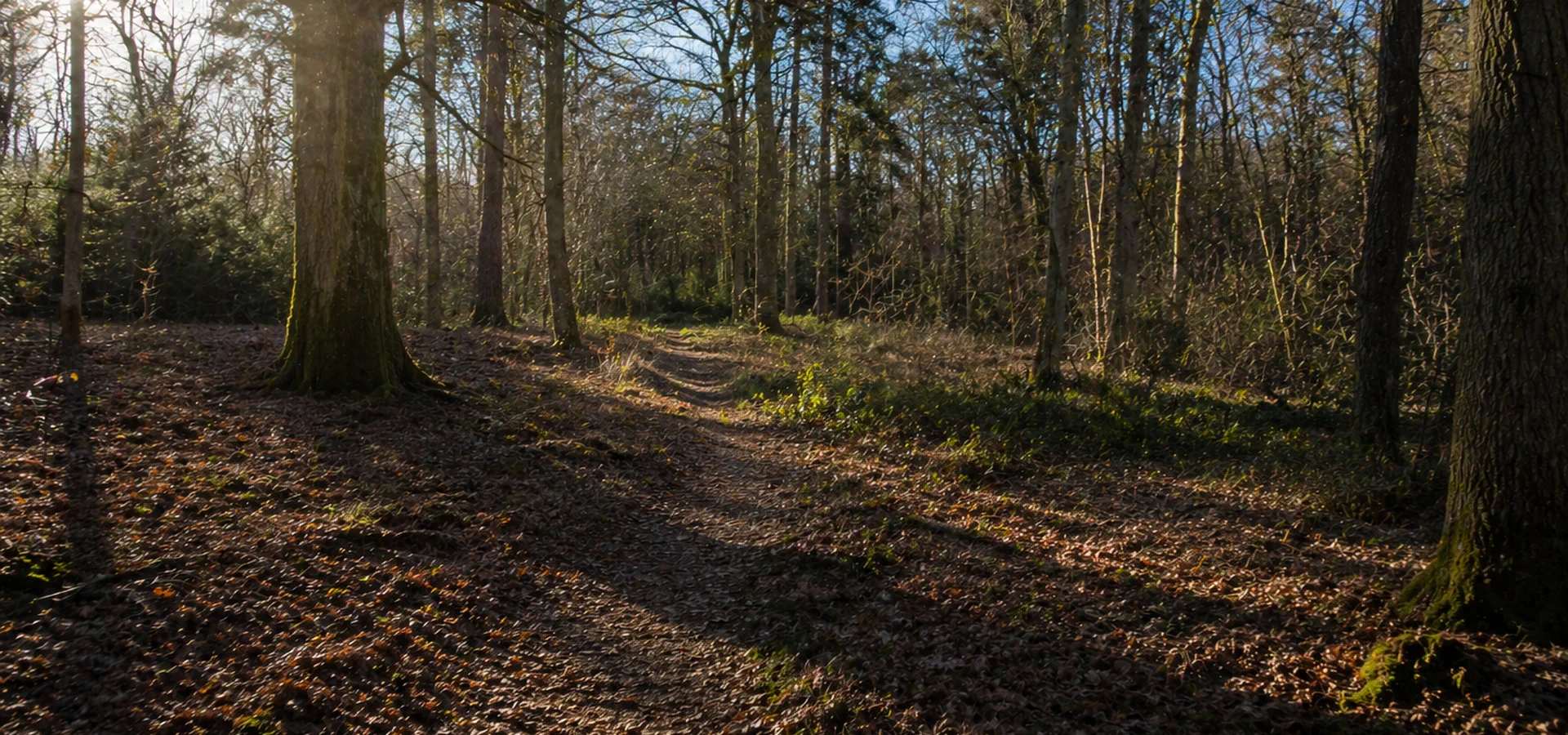
The Habitat Data Your Planning Application Depends On
Before any assessment of ecological impact can be written, the habitats present on your site need to be mapped and classified accurately. UKHab is the framework that does this. It gives every habitat type a standardised classification that is consistent across sites, compatible with national datasets, and directly compatible with the statutory biodiversity metric used to calculate biodiversity net gain.
That last point is increasingly significant. Since mandatory biodiversity net gain came into force under the Environment Act 2021, getting the habitat classification right at the start is no longer just good practice — it determines the baseline figure against which your development’s biodiversity performance will be measured. An inaccurate or inconsistent baseline can undermine the entire BNG calculation.
We carry out UKHab surveys as a standalone service and as an integrated part of PEAs, EcIAs, and BNG assessments. Our ecologists are trained and experienced in the full professional edition of the classification system and produce outputs that are compatible with GIS, the statutory metric tool, and submission to local planning authorities.
FAQ
UKHab Surveys — Your Questions Answered
What UKHab is and where it came from
The UK Habitat Classification was developed from 2013 and released in 2018 as a replacement for the Phase 1 Habitat Survey method that had been industry standard since the 1990s. It is maintained by UKHab Ltd, a not-for-profit organisation established in 2020 to ensure the system remains current, accurate, and fit for purpose as ecological practice evolves.
The Phase 1 method served its purpose, but its criteria for classifying some habitats were not precisely specified and were open to interpretation. That inconsistency caused problems in two directions: ecologists could reasonably disagree about how to classify a habitat, and planning authorities could not reliably compare survey data between sites. UKHab addresses both problems by providing a detailed, standardised hierarchy that applies consistently across all terrestrial and freshwater habitats in the UK.
The classification aligns with European-level habitat categories and integrates with the statutory biodiversity metric, making it the only habitat survey approach that can properly feed into mandatory BNG calculations.
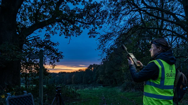
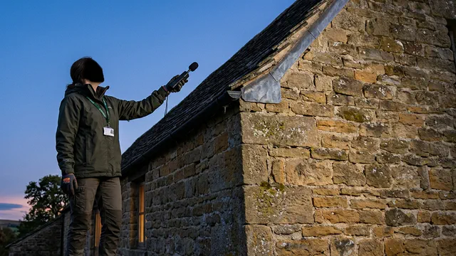
What a UKHab survey involves
A UKHab survey is a structured field walkover carried out by a qualified ecologist. The surveyor maps the site, identifies every distinct habitat parcel, and classifies each one using the UKHab system. For each habitat, two additional assessments are recorded alongside the classification itself.
The first is distinctiveness: a measure of how ecologically valuable the habitat type is. The statutory biodiversity metric assigns a distinctiveness score to each UKHab habitat category, from low for habitats such as amenity grassland to very high for habitats such as ancient woodland or species-rich chalk downland. Distinctiveness is fixed by the habitat type and does not vary between sites.
The second is condition: a measure of the ecological quality of that specific habitat parcel on your site. Condition is assessed against published criteria for each habitat type and can range from poor to good. It is condition, combined with distinctiveness, that determines the biodiversity value of each habitat parcel in the metric calculation. Two fields of the same habitat type in different condition will have different biodiversity values and different implications for the BNG calculation.
Both assessments require botanical knowledge and ecological judgement. This is why UKHab surveys require a higher level of expertise than Phase 1 surveys, and why engaging a consultant with a demonstrable track record in vegetation survey matters.
How UKHab feeds into biodiversity net gain
Mandatory biodiversity net gain requires most planning applications in England to demonstrate that the post-development biodiversity value of the site exceeds the pre-development value by at least ten per cent, measured using the statutory biodiversity metric.
The metric is built on UKHab. Each habitat parcel is entered into the metric tool with its UKHab classification, area, distinctiveness score, and condition rating. The tool calculates the biodiversity unit value of each parcel and sums them to produce the total baseline figure. That baseline is then compared against the predicted post-development habitat value to determine whether the required uplift is being achieved.
If the baseline habitat survey is inaccurate — habitats misclassified, condition incorrectly assessed, or boundaries imprecisely mapped — the baseline figure will be wrong. An inflated baseline makes the required uplift harder to demonstrate. An understated baseline may sail through initially but creates risk if the survey is challenged by the planning authority’s ecological consultee. Getting the UKHab survey right from the start protects the integrity of the entire BNG calculation.
How UKHab differs from the Phase 1 Habitat Survey
The Phase 1 Habitat Survey used a relatively simple set of target notes and broad habitat categories that gave a quick overview of a site’s ecological character. It was not designed to feed into quantitative biodiversity assessments, and its habitat categories do not map directly onto the statutory biodiversity metric.
UKHab uses a hierarchical classification system with over 140 habitat types organised into ten broad categories. Each habitat type is precisely defined, with specific criteria distinguishing it from similar types. The system covers habitats that Phase 1 did not adequately distinguish: different types of grassland, hedgerow structure and species composition, urban and built habitats, freshwater habitats, and others.
The outputs are designed for use with GIS platforms, making it straightforward to produce accurate habitat maps that can be overlaid against site plans, submitted digitally to planning authorities, and used directly in the metric tool. Phase 1 data cannot be directly used in this way and requires translation before it can inform BNG calculations.
When UKHab surveys can be carried out
A UKHab survey can be undertaken at any time of year. Unlike species surveys, which have strict seasonal windows, habitat classification is not constrained in the same way.
However, the optimal period for surveying is April to October, when vegetation is actively growing and plants can be more reliably identified. This matters particularly for the condition assessment, which depends on identifying indicator plant species within each habitat parcel. Outside the growing season, some condition criteria are harder to assess confidently, and the ecologist may need to note limitations in the assessment or return for a supplementary visit.
For planning applications with tight timelines, it is worth factoring in whether the survey timing will allow a robust condition assessment or whether a seasonal limitation note will be required in the report. We can advise on this when you get in touch.
The outputs and how they are used
A UKHab survey produces a habitat map and a written survey report. The habitat map shows every habitat parcel on site with its UKHab classification code, boundary, and area. It is produced in GIS and supplied in a format compatible with submission to the local planning authority.
The written report describes each habitat type present, records the condition assessment for each parcel, identifies any Priority Habitats, and sets out the implications for the planning application. Where the survey is carried out as part of a PEA, those findings are incorporated into the broader appraisal report. Where it is a standalone baseline survey for BNG, the habitat data is entered into the statutory metric tool to produce the biodiversity unit calculation.
The survey also identifies any habitats that may support protected species, helping to define the scope of any targeted species surveys needed before the application can be submitted.
What it costs and how to get started
UKHab survey pricing depends on the size of the site, the complexity of the habitats present, and whether the survey is being carried out as a standalone exercise or as part of a broader ecological assessment. Standalone UKHab surveys for straightforward sites are competitively priced; larger or more varied sites require more time in the field and a more detailed written output.
To get a quote, provide us with your site address, an indication of the site size and land use, and a description of what you need the survey to support — PEA, BNG baseline, EcIA, or standalone. We will confirm the scope and provide a fixed price promptly.

Deliverables
UKHab and condition data the statutory metric can ingest
Habitat typing and condition scoring captured once — feeding PEA, EcIA and mandatory biodiversity net gain without reclassification drift.
Guides & insights
Ecology news & guides
Seasonal windows, baseline surveys and planning timelines — written for developers and agents.

More surveys
Looking for a different ecology survey?
Compare habitat baselines, species follow-ons and BNG-ready mapping from one coordinated ecology overview.